UTILITY LOCATING SERVICES
UTILITY LOCATING SERVICES
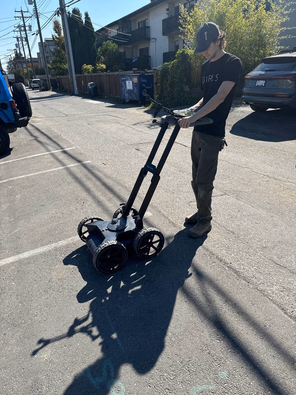
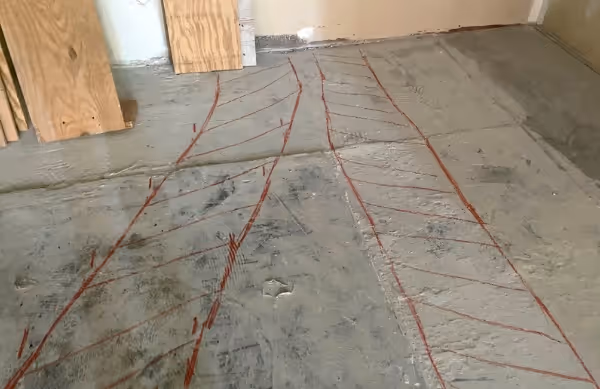
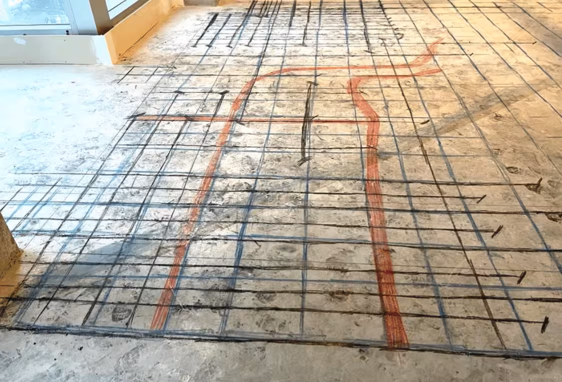
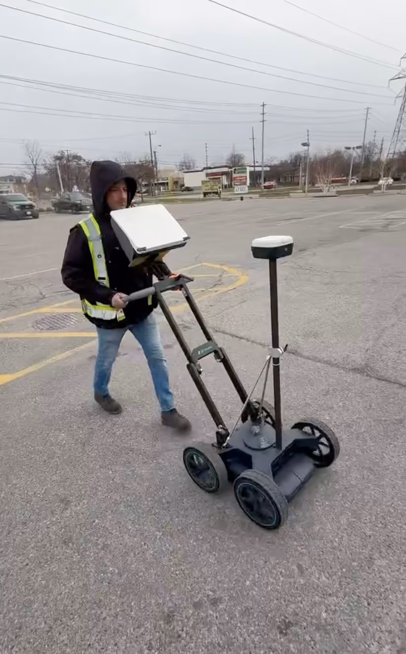
GPR utility locating and underground scanning to locate underground utilities - cables, pipes, and conduits - before digging or excavation.
Get A QUOTE


What is Utility Scanning (Utility MAPPING)?
Ground Penetrating Radar for Locating Utilities (GPR)
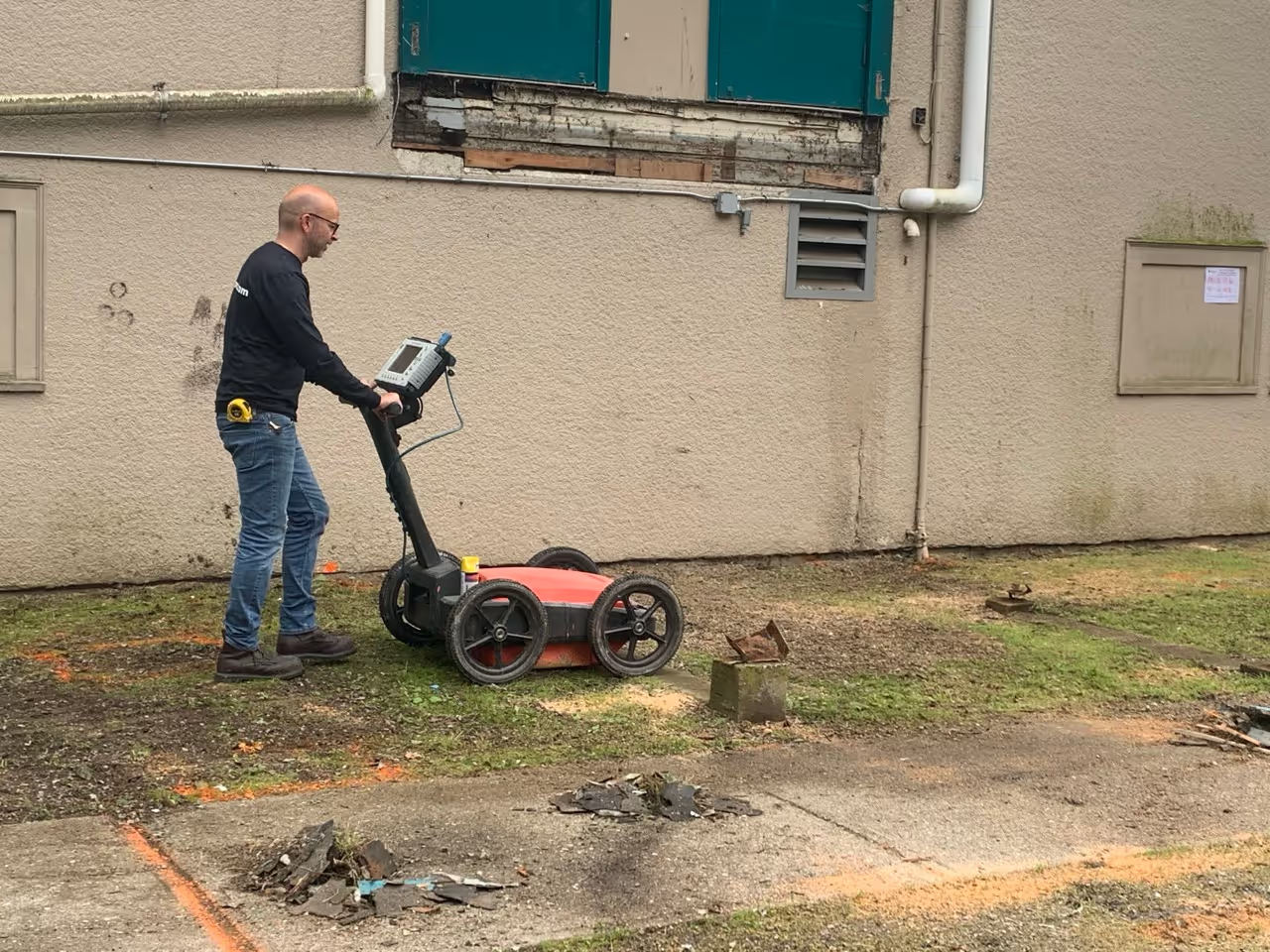
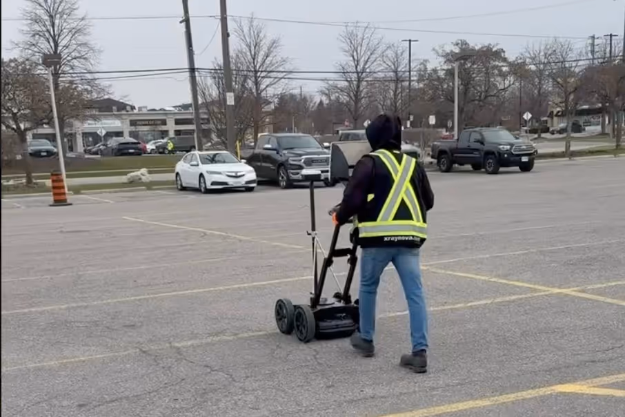
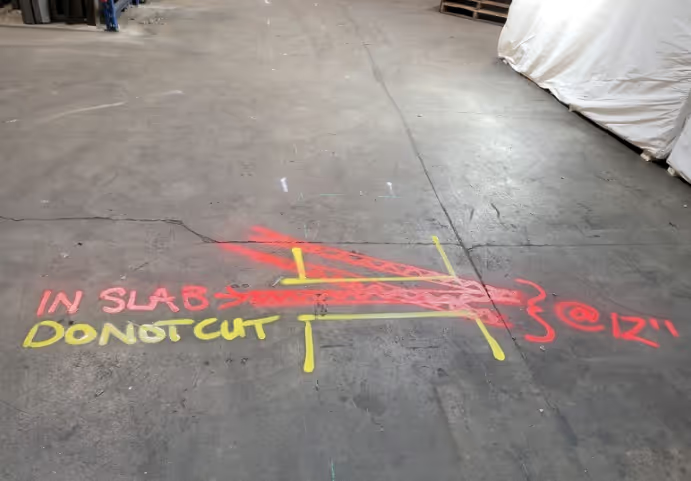
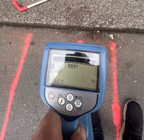
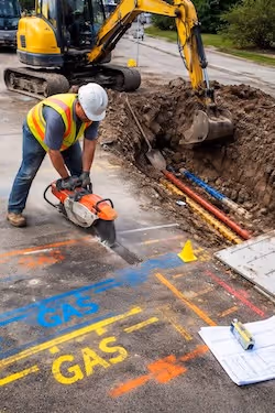
Utility locating - also called utility scanning - is the process of using ground penetrating radar for utility locating to find utilities before digging and confirm underground utilities in the work zone. Our underground scans support underground services verification and underground radar mapping so crews can plan excavation with fewer surprises.
• Find cables underground (power and communications)
• Find pipes underground (water, storm, sanitary)
• Locate existing services like conduits and duct banks
• Private utility locating for unknown/undocumented lines
• Scanning for underground services
Power/communications lines
Water and sanitary pipes
Voids and Unknown objects
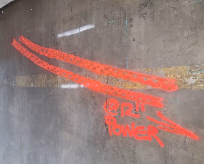
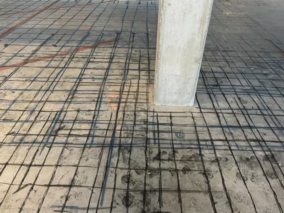
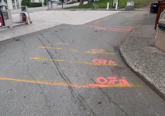
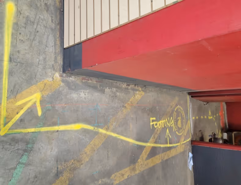
Real Site Photos of
utility Mapping
NOVA – ON TIME, ON SITE, WITH RESULTS YOU CAN TRUST
YOUR PROJECT From
START TO FINISH
CONTACT US
Tell us: What area needs underground scanning? (trench line, bore path, excavation limits)


BOOK A TEAM
We schedule a crew for GPR utility locating and underground utility detection.
GET A SCAN
On site, we run ground penetrating radar for locating utilities and mark detected targets.

REVIEW REPORT
Get a Job Summary Report (typically within 24 hours) supporting underground services verification.
CUTTING & EXCAVATING
If needed, we coordinate with trades so your team understands the scan results before digging.
Nova — it’s about RELIABILITY
info@xraynova.com
Vancouver - 604-435-3771
Toronto - 647-797-6682
Frequently asked questions
Ground penetrating radar depth depends on soil conditions, moisture, congestion, and target type. We’ll confirm realistic expectations after reviewing your site. Typically, our utility scans can detect targets up to ~12 ft deep in suitable conditions.
GPR utility locating sends radar signals into the ground and interprets reflections from subsurface changes. This helps identify likely utility paths and supports scanning for underground services in the work area.
Yes. The main limitation is schedule and site access. Our goal is helping you clear the work safely, not limiting you to the original list.
GPR is reliable when used properly. With our team’s 15 years’ experience and top-tier gear, we deliver solid results.
GPR detects changes/reflections in subsurface materials. Depth and object identification can be affected by wet soils, clay, rebar/mesh, congested utility corridors, and site conditions.
.png)